Handy Pocket Guides
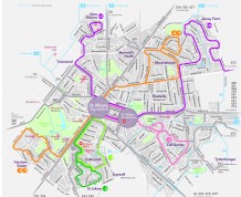
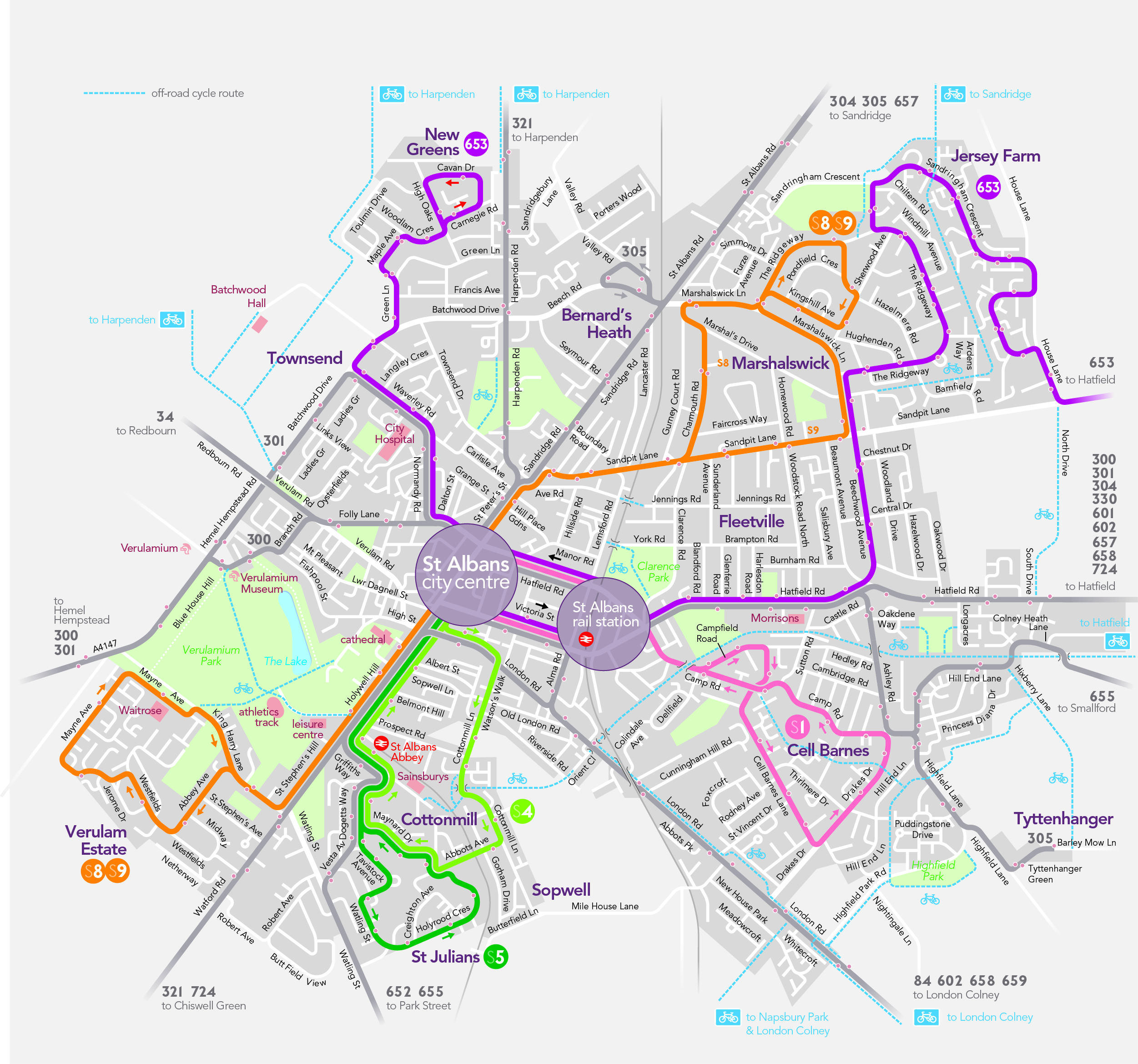
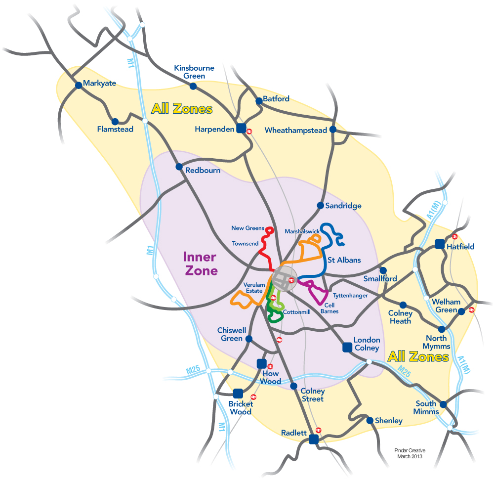
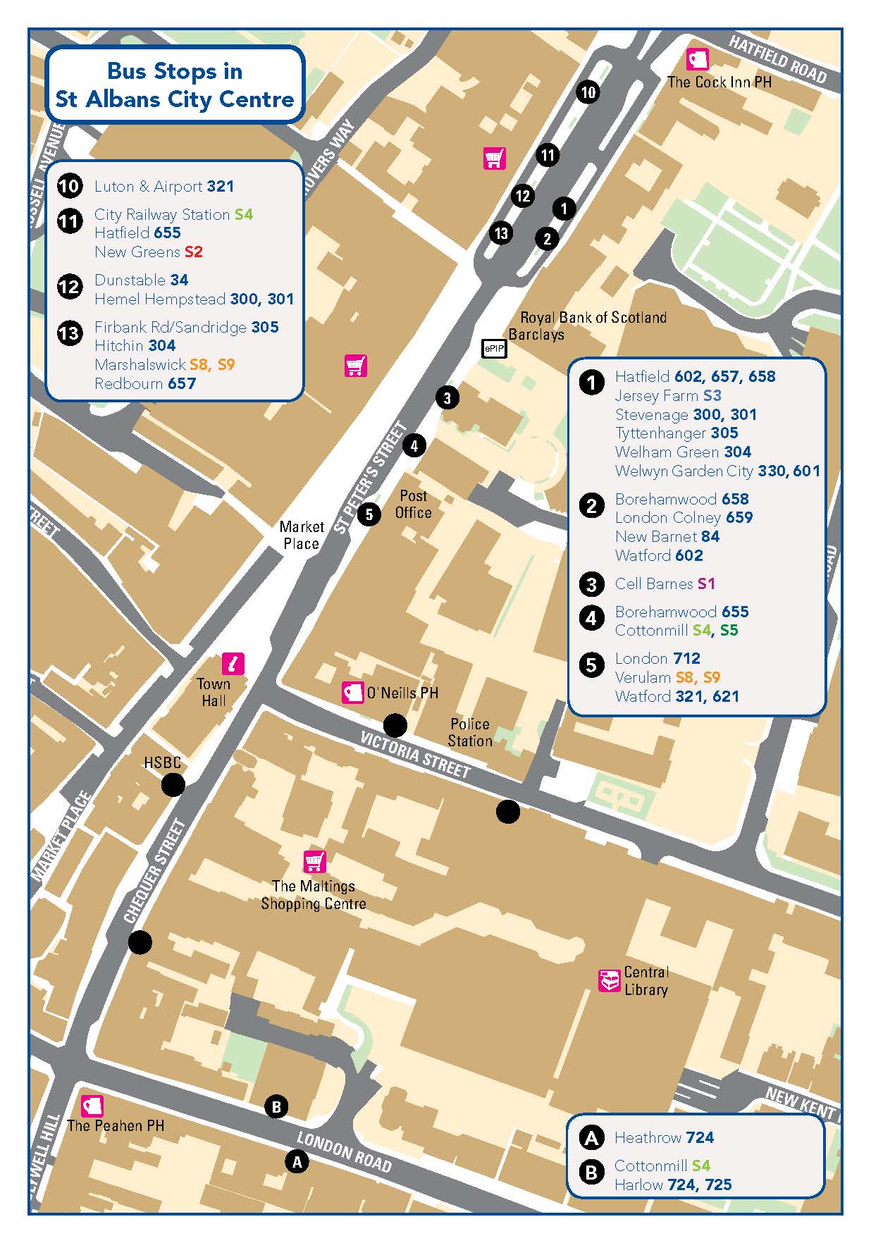
The St Albans local bus network is provided by the city “S-Routes” which provide outlying residential districts including Cell Barnes, Cottonmill, Jersey Farm, Marshalswick, Mile House, New Greens, St Julians and Verulam Estate with frequent services to and from the key city center locations, St Peter’s Street and the railways stations. Longer-distance inter-urban services also provide travel between St Albans center and suburbs and neighboring towns including Harpenden, Hatfield, Hemel Hempstead, Watford, and beyond. Full details of all services can be found on the Service Details page.
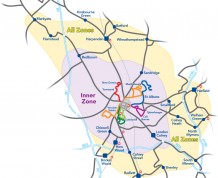
Network St Albans has worked with the bus operators to create the St Albans BUSnet ticket. This is a multi-operator bus ticket, which can be used to provide unlimited travel throughout the purchased zone(s) within the Network St Albans area. Buy a ticket on the first bus you board, then use it on any bus, regardless of the bus operator, for travel within the boundaries of the zone(s) for the period of validity of the ticket. Day and Weekly tickets are available. See St Albans BUSnet.
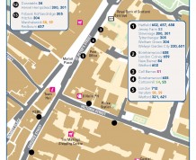
To assist with travel planning we have produced a range of travel maps.
A Pocket Guide to Network St Albans, available from Information outlets (Tourist Information Centre, libraries, Civic Centre), will help you find your way around the network.
For more information on fares, please go to the individual operators’ website.