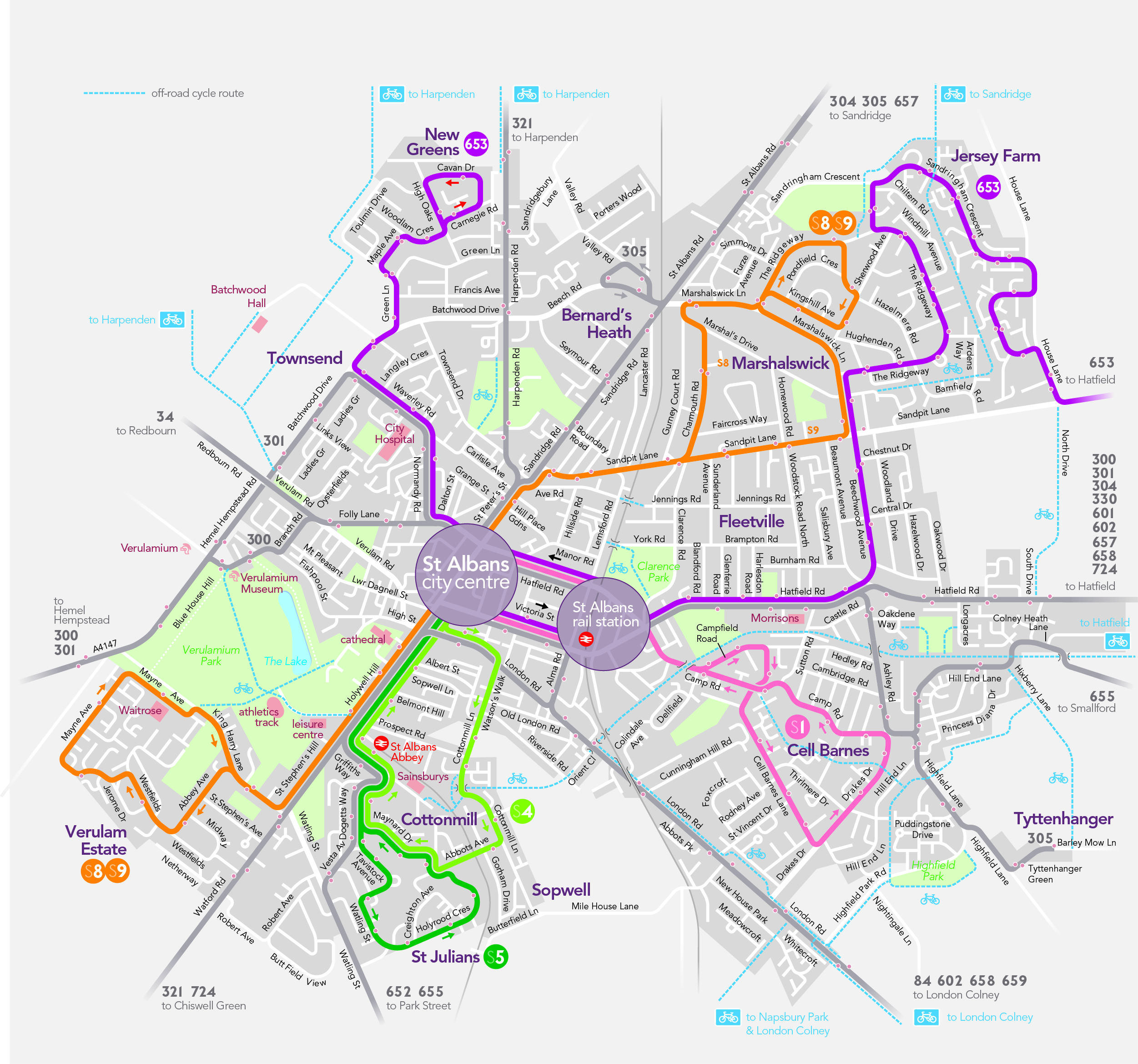
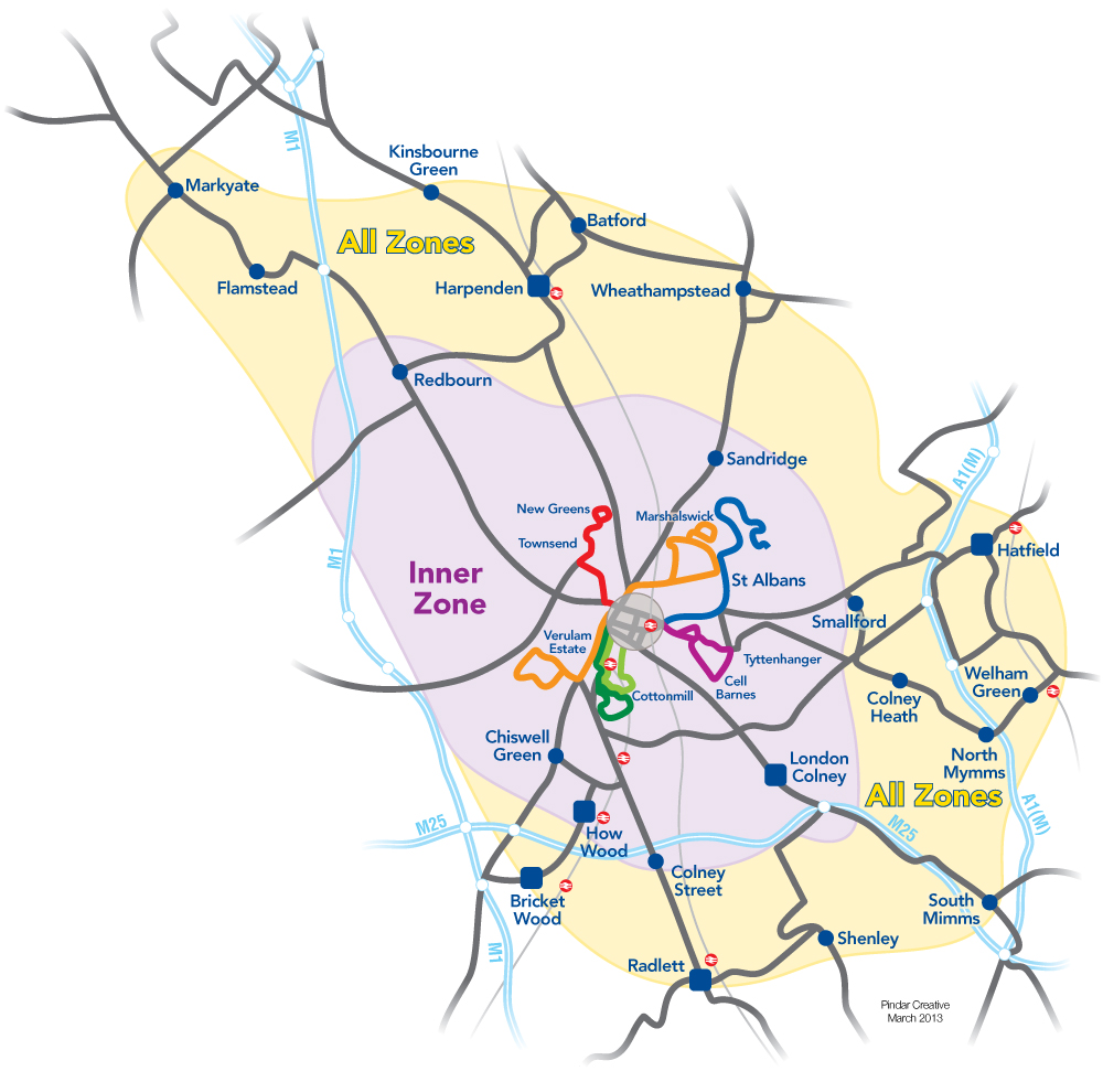
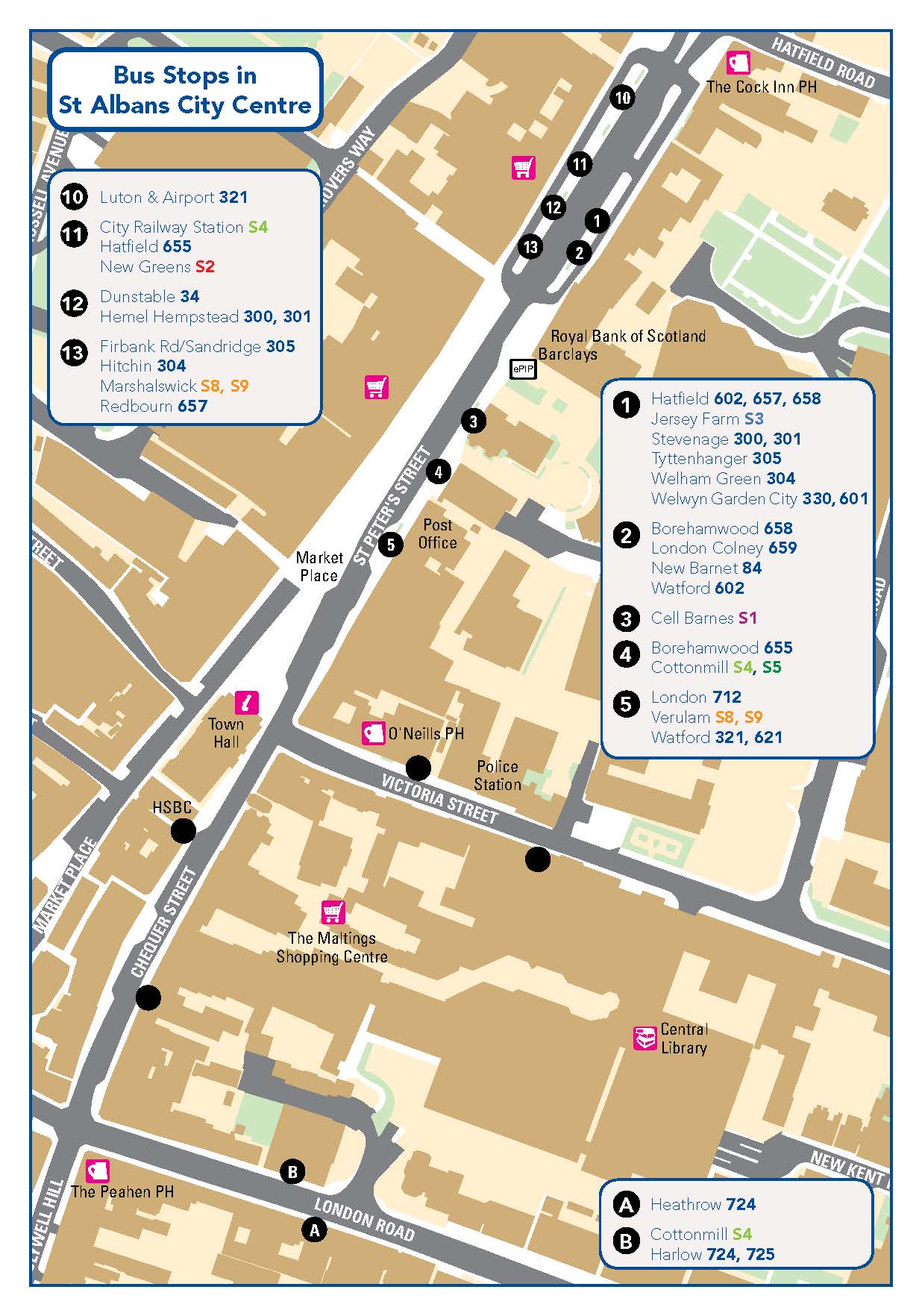
The Network St Albans partnership has developed an integrated colour-coded Network St Albans Travel Map which provides clear, simple and understandable information for bus passengers. The map shows the city’s "S" routes, which have also been developed into linear maps which detail the names of individual stops. Also available is the St Albans BUSnet Zone Map which outlines the areas of travel permitted for the zone(s) purchased.
A Voluntary Quality Partnership brings together all stakeholders with an interest in improving local transport. The key players are the local authorities, transport operators (bus and train), interest groups, businesses…
Read full article »Baroness Kramer, Under Secretary of State for Transport visited St Albans on 24th October to see how the work of the Network St Albans Quality Partnership has delivered a package of…
Read full article »